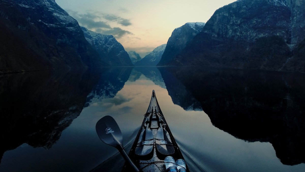

 The dessert-like eastern gorge, east of Dalles, Oregon
by Neil Schulman
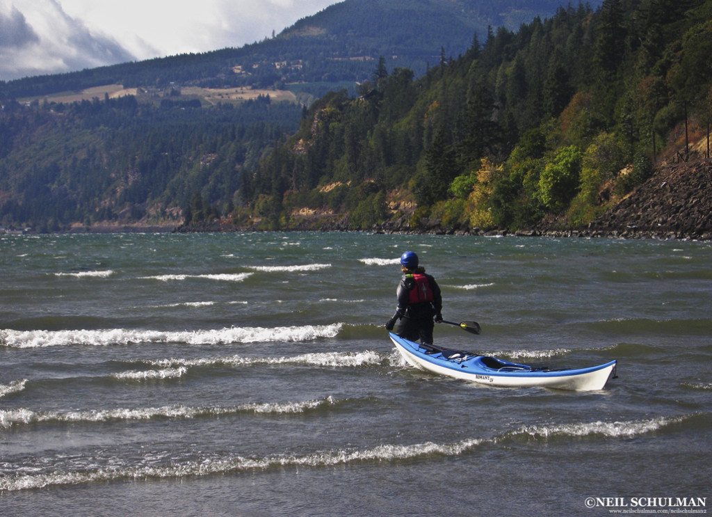
I leaned back as far as I could, hoping for the bow to rise. It was too late. The bow drilled into the back of the wave in front of me, burying me in water up to my waist and ending my umpteenth surf ride of the day. When my kayak resurfaced, I started paddling again, building speed to catch another swell.
The wave surged shoulder-high and green, its water comfortably warm on my bare arms. I rode about thirty yards, slid off, straightened my boat and started working on the next wave. Behind me, I could hear Karl cackling with the glee of a ten-year old. Kim was a few football fields ahead, yellow boat barely visible in a sea of whitecaps. As usual, there were no other paddlers in sight.
This wasn’t in Hawaii, nor was it a hallucination induced by a too-tight neck gasket. It was on a downwinder in the Columbia River Gorge, only a forty-five minute drive from my house in Portland.
For me, the Gorge is one of the best sea kayaking destinations on the planet. Portland and Hood River are both paddling towns, but somehow it seems the majority of sea kayakers have yet to take full advantage of the Gorge. I’ve spent 15 years kayaking in the Gorge, and in that time I’ve seen a grand total of three other paddlers.
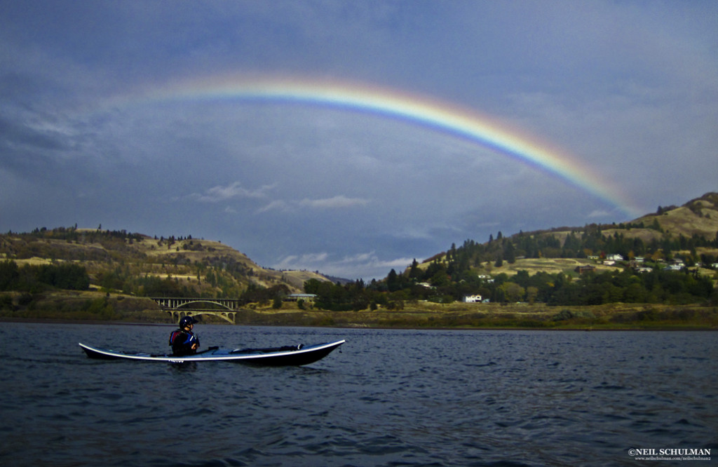 A rainbow arcs over the mouth of the Klickitat River
The Gorge
The Columbia River Gorge is a hundred mile-long, three thousand-foot-deep U-shaped valley straddling the Oregon-Washington border. Carved by ice-age floods, it connects the mild and wet climate of the western Cascade mountain range with the extremes of the continental high desert.
A National Scenic Area, the Gorge is defined by basalt cliffs, waterfalls and endless options for paddlers. Within it you can find rainforest and rain, sagebrush and sun. You can find gentle breezes and gale force wind, flat water, big waves, or swirling river currents.
Below Bonneville Dam, 40 miles east of Portland, the Columbia River zips seaward with a consistent current, strongest in spring, occasionally reaching 5.2 knots. Upstream of Bonneville and the Dalles Dam, you’ll find a lighter current, commonly less than 1.5 knots, but still moving downstream noticeably in spring, creating steep waves against the Gorge’s prevailing westerlies.
Conditions at the Gorge vary, but there’s almost always good paddling to be found somewhere. In calm conditions, there are scenic paddles of almost any length. When the wind’s up, plan a downwinder and surf until your arms are like rubber. When the wind’s too strong, head up a side stream and play in river current.
Gorge Tours
Here are two of my favorite calm-day Gorge tours. Both can be done as downwinders as well.
The Western Gorge: Dalton Point to Chinook Landing (16 miles)
Launch from Dalton Point near Multnomah Falls and cross to Phoca Rock midriver to paddle beneath dramatic waterfalls and sheer cliffs and through a delta teeming with waterfowl and bald eagles. Below Bonneville Dam, this run is done east to west with the current on a calm forecast or an east wind.
Give a wide berth to sea lions, which are often hauled out on the rock or playing in the eddylines around the rock. Then wall-crawl below the cliffs of Cape Horn on the Washington side below several waterfalls. Pass Reed, Flag, and McNary islands before crossing the mouth of the Sandy River, a series of shallow, braided channels where mixing waters attract a congregation of waterfowl, eagles, otters and migrating salmon.
Take out at Chinook Landing, a large public boat ramp, on river left. A side trip into the Sandy adds more play in current. In summer and fall when the current is weak, you can also do a portion of this trip from Dalton Point by paddling downstream in the morning and riding the afternoon wind back to your car.
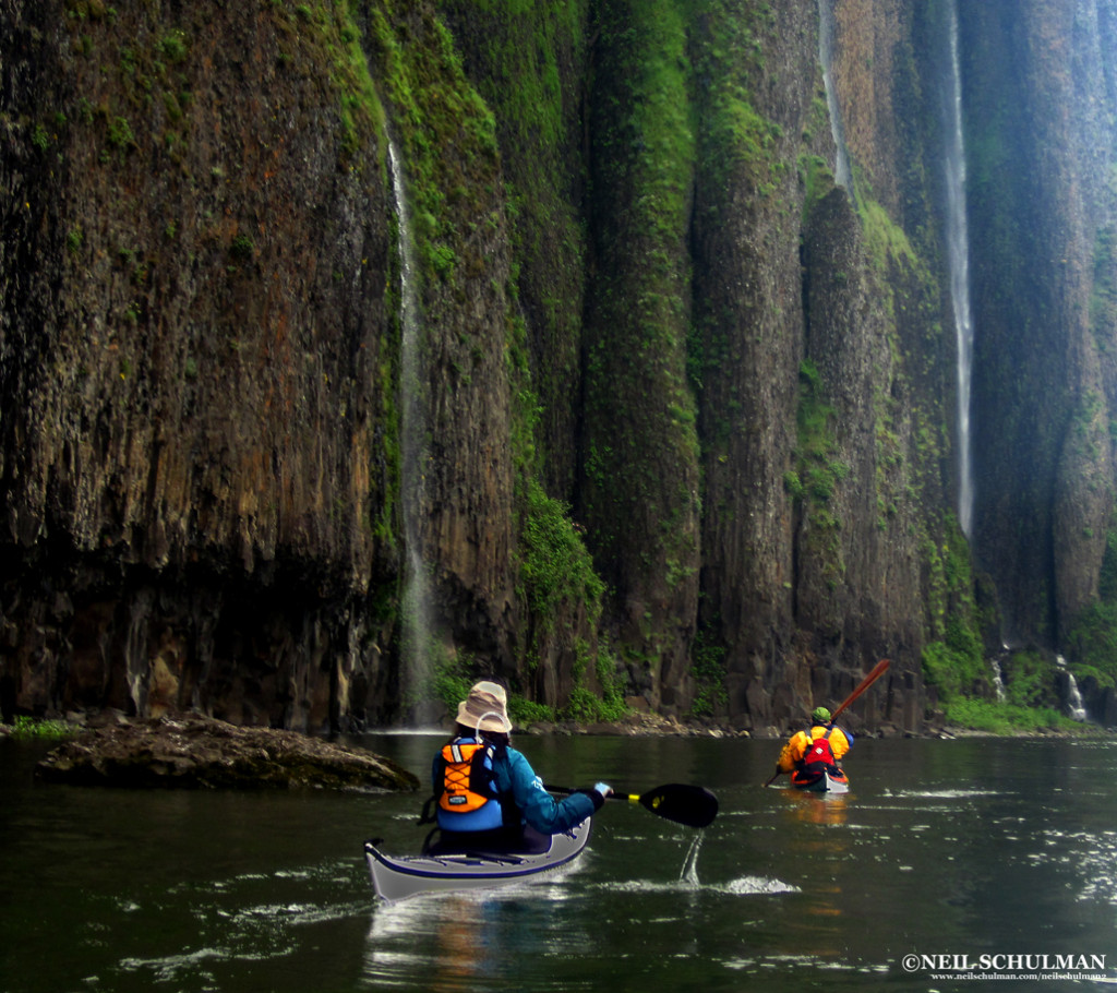 Paddlers beneath the waterfalls of Cape Horn in the rainforest at the western end of the Gorge
The High Desert Miller Island: (9 miles)
In the dry country East of the Dalles, Miller Island offers hiking as well as paddling. From the launch at Deschutes River State Park, circumnavigate the island clockwise: the north side, ominously named “Hellgate,” funnels westerlies.
Get out and hike to the top of the basalt cliffs that ring the island for stunning views of the Gorge and the island’s interior. In spring, you’ll see an array of wildflowers in bloom, including some found nowhere else in the world but the Gorge, which hosts a number of endemic plants.
The island was once a Native American village site for the many peoples that lived and traded along the Columbia River, such as the Wishram, Wasco, and Northern Paiute. Pictographs are visible from the water and along the cliffs. At the upstream end of the island, play in the wind and current eddies created by a series of rock islands, often under the watchful eye of several hundred Ring-billed gulls.
Continue around the island to Deschutes River State Park, or continue east to Maryhill State Park on the Washington side. The island is closed to camping, but camping is available at either Deschutes River or Maryhill.
 Jodi Wright launches into Force-4 winds near Hood River
Summer Downwinders
Windsurfers and kiteboarders have flocked to the Gorge for decades. The same factors that lured them—predictable wind, sunshine, and easy access—make it an ideal destination for sea kayakers to surf or to learn how to manage wind.
Gorge winds are caused by air pressure differences between the marine-influenced west end of the Gorge and the continental climate of the eastern end.
The eastern region is warmer from spring through fall, which creates lower air pressure compared to the cooler west. As air flows from high pressure to low, and the Gorge acts as an enormous funnel.
West winds strengthen and create bigger waves as they move east, so paddlers seeking more adrenaline should head toward Hood River or farther east. Kayakers seeking a milder day can paddle near Cascade Locks and Wind River, depending on the forecast.
Begin your downwinder by checking the forecast (see appendix) for several areas of the Gorge, and recheck conditions on the morning of your paddle. Look at the conditions before you set up your shuttle, and shift to a spot farther west if they look to intense.
Gorge wind strength is so localized it’s easy to match your skills by adjusting your paddle route to meet conditions. Expect westerlies to build during the day and ease around sunset.
My philosophy as a downwinder is simple: point downstream, surf, cackle with laughter, wash, rinse and repeat. Unlike surfing in the ocean, you won’t have to pound back out through the surf after each wave, get windows shaded by a wave closing out, or develop an embarrassing neck rash from neck gasket, sand, and saltwater.
When you want to surf again, just point downstream and go. If you miss a wave, there will be another one in a few seconds. When you need a rest, just float for a few minutes or work your way to shore and find a wind eddy.
Of course, every paddler has a different level of skill and comfort in wind. Wind below Force 3 is generally too small to surf; our group of skilled paddlers seeks wind in the Force 5 range (17-25 mph.)
Force 6 is exhilarating, but you’ll need to be on your game if anything goes wrong. In spring, strong current magnifies the wind-against-current dynamic and generates slightly larger sea states than the same wind conditions during summer.
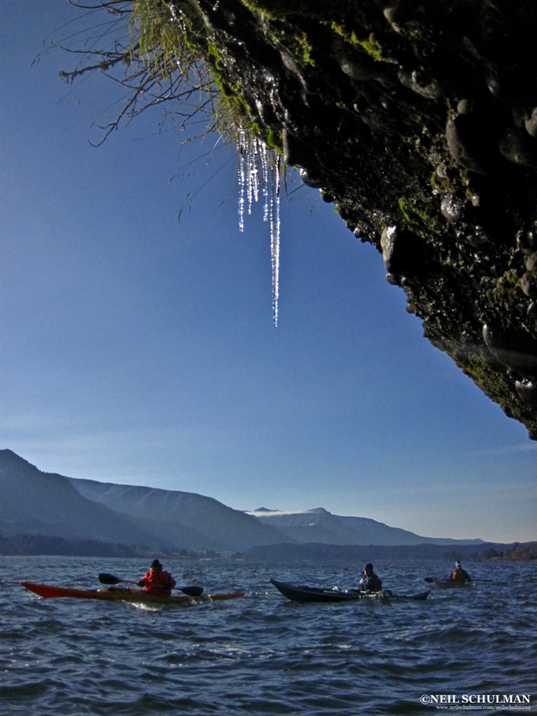 Icicles near Stevenson, WA on a cold day of the easterlies
Three Downwinders
Stevenson to Home Valley: 7 miles
Leave a shuttle car at Home Valley Park at the mouth of the Wind River, then launch at the public boat ramp in Stevenson, WA. The Washington shore is an intricate network of cliffs, coves and rock islands that provide breathtaking scenery and a good introduction to downwinders.
There are many nooks and crannies where you can rest, regroup, and practice turning upwind and downwind. In fall, spawning salmon in the Wind River put on an impressive showing.
Protect their spawning gravel by not walking in the shallows. After you shuttle back to Stevenson, walk down the block to Walking Man Brewing for a beer on the patio.
Viento State Park to Hood River (10 miles)
This run, located farther east, often has slightly stronger wind and larger waves on a westerly. Leave a car at the Hood River City Marina, and then drive west and put in at Viento State Park ten miles to the west.
Start with a warm-up, paddle east (upwind) a quarter-mile to a large rock and group up in the wind eddy. Then cross to the Washington side and venture up the Little White Salmon River. Like the Wind River, it will be full of spawning salmon in the fall. Then surf upriver, crossing back to the Oregon side at the mouth of Hood River after passing its shallows, and take out at the city marina.
On this run you’ll encounter windsurfers and kiteboarders, and have a chance to play at the aptly-named Swell City. Then take your pick of Hood River’s many pubs where you can relax with a local brew.
Hood River to Mayer State Park (14 miles)
On this run, you’ll put in at the Hood River marina, follow several bends in the Columbia, and cross the mouth of the Klickitat River before ending at Mayer State Park. Wind is milder on the inside of the bends.
The lower Klickitat River is well worth a side trip to explore rock cliffs and oak woodlands, play in the river current, or watch for the local populaton of wild turkeys. A half-mile upstream, paddlers reach the first set of riffles. I’ve spent entire days practicing ferries, eddy turns, peel outs, and upstream attainments here.
The Columbia pinches to its narrowest point between the mouth of the Klickitat and Mayer State Park, where waves are amplified as the accelerated current in this narrow passage meets the wind.
Save some energy to get your best surf rides of the day here, before heading for the Thirsty Woman Pub in Mosier.
The Easterlies
During winter, when the eastern high desert is colder than the temperate zone in the west, the entire Gorge wind factory runs in reverse. Colder air in the desert creates high pressure in the east and an east-to-west wind. Just as a west wind creates waves in the east, an east wind creates waves in the western part of the Gorge.
On an day of easterly wind, the aforementioned runs can all be paddled in reverse, from east to west: Home Valley to Stevenson, Hood River to Viento, Mayer to Hood River, etc. They will also reverse in difficulty: the further west, the stronger the wind and the rougher the conditions. The toughest conditions will be at Cape Horn, which is usually dead flat on a westerly. East wind flows with the current, which creates longer wavelengths for better surfing, but most east wind comes in the winter and is bone-chillingly cold.
Knowing the Wind
Windsurf-oriented smartphone apps such as iWindsurf, WindGuru, and NOAA weather are a boon for downwinders. They provide updates and forecasts, which make changing your itinerary easy as you head out to the Gorge.
The app can even send you updates when the conditions hit the perfect zone, so you can drop whatever else you’re doing to go paddle.
Downwinder Safety
Downwinders pose four particular safety issues: weather interpretation, wind management, group cohesion and sharing the river with windsurfers and kiteboarders.
Weather Interpretation
Humans are prone to exaggeration. Like the fish that got away, paddling stories tend to grow with the telling. In the Gorge, exaggeration can be dangerous.
I’ve heard many paddlers swear they were paddling in 35 mph winds, when I know for a fact it was really Force 4 (14-20 mph) from both my own measurements and the conditions report. This exaggeration leads them to honestly believe they have the skill to paddle in 35 mph winds, a recipe for biting off more than they can chew.
Learn to calibrate actual wind strengths with sea conditions and your paddling ability. Learn the Beaufort Scale, keep a paddling log, and refer to it when you’re wondering what 23 mph feels like.
Wind Management
You can’t control the wind, but you can control your boat in the wind. Turning your boat up and downwind and maintaining a course across the wind are basic skills for the Gorge.
Rudders and skegs help, but the paddler is the critical element. Learn to use paddle strokes and edging. You can lean forward and back, changing the trim of your kayak to make the wind help you turn. Grasping the effect of wind on a kayak requires experience in strong wind, which makes beginners nervous. Spend some time practicing these techniques with skilled paddlers in an onshore wind with a safe landing. When surfing, capsizes will happen.
Rolling in wind is much easier on the upwind side, and reentery and rolls often succeed because the paddler knows on which side they’re rolling. If someone does swim during a downwind run, there’s one major imperative: hold on to the deck lines. If the swimmer lets go, the empty kayak will quickly blow downwind while he or she stays in place, a challenging scenario for rescuers. In the warm water of summer, hypothermia usually isn’t a problem.
The east-wind runs of winter subject paddlers to more dangerous water temperatures.
Group Cohesion
Groups get easily scattered in the wind. Voices and whistles are often inaudible. Skilled surfers naturally speed ahead of more tentative paddlers, who are more likely to get in trouble.
One exception is during spring runoff with a westerly blowing, when skilled surfers tend to catch rides mid-current but make slow upriver progress while beginner paddlers who stay sheltered near the shoreline will get ahead of the rest of the surfers and remain easily visible.
In any case, a skilled paddler should stay upwind of (behind) the back of the group where they can see and respond quickly. Venturing out in the wind requires the same planning as any successful trip in challenging water.
Make plans for if the group gets separated, plan bailouts, map points for reassessment, maintain VHF communication and conduct an accurate assessment of skills.
Windsurfers & Kiteboarders
Paddling the Gorge means sharing the river with windsurfers and kiteboarders. While it can be unnerving at first, paddling with windsurfers is safe as long as they know you’re there.
Windsurfers tend to move predictably back and forth across the wind, while kayakers usually paddle downwind. That means they’ll be looking at the wide side of a kayak and they will spot a group easily. Windsurfers usually have a lot of control and can avoid you as long as you maintain a course.
Kiteboarders are connected to their kite by a cable, and I give them a wider berth to avoid the cable. Since the kite has more surface area and is higher aloft than a sail, they’re often slightly less predictable, though they tend to be on the river in lower winds than windsurfers.
I avoid the Hood River shallows because it’s popular with beginner boarders who have less control.
Now, back to my fun on a summer day in the Gorge. We ate up the miles until our smiles were exhausted. We found a sheltered cove along the northern shore for lunch.
While we ate and filled up our Tupperware with local blackberries, we watched six-person Hawaiian-style outrigger canoes fly downwind, training for an annual race through the Gorge. Later, we shared a pub with the racers and marveled again at how few sea kayakers paddle in the Gorge. It’s been overlooked for far too long.
Neil Schulman is a Portland-based photographer and writer. In his spare time, he also teaches kayaking and does environmental work. You can see his writing and photography at www.neilschulman.com/neilschulman2
Appendix:
Columbia Gorge Weather forecasts:
Weather.gov
Smartphone Apps: